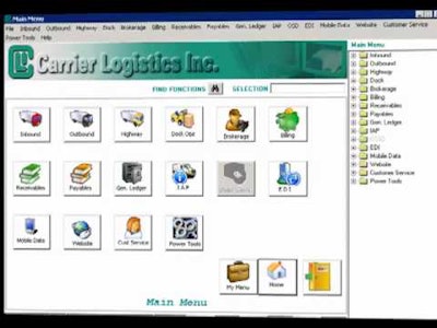
 Carrier Logistics’ Facts transportation management software system for multi-stop operations has a built-in feature, Routronics, that matches orders to routes and sequences the stops to reduce mileage.
All trucking companies realize benefits by using data visualization tools, such as mapping, to help with real-time vehicle route management and dispatching.
Carrier Logistics Inc. (CLI) says the mapping enhancement for its FACTS software transforms large amounts of data into a color-coded visual representations of a fleet’s current operation to make it easier for users to spot trends and make decisions.
Its mapping incorporates Bing Maps, a Microsoft product, that also delivers real-time traffic information and weekly system updates.
John Cesario, senior transportation consultant for Tarrytown, N.Y.-based CLI, has installed the FACTS software with mapping and routing for nearly two dozen trucking companies around the country.
From serving in the U.S. Marine Corps, Cesario says he learned a simple formula for implementing software: analyze a need and plan a project to meet that need.
Cesario recently helped FMD Distribution, a niche less-than-truckload carrier based in Kearny, N.J., install the FACTS software with mapping. The company credits the mapping enhancement for a quick return on investment.
He also helped another CLI customer, Custom Companies in Chicago, replaced their dispatching system and automated their delivery planning process with the FACTS software with mapping enhancement.
For Baton Rouge Cargo in Louisiana, Cesario managed a start-up project that enabled the firm to centralize dispatching in one terminal, replacing a four-terminal operation and reduce costs. Likewise for JA Frate of Crystal Lake, Ill., Cesario reduced a delivery planning process from six hours to less than two.
“Out of all of the people here,” said Don Adams, president and co-founder of CLI, “I think John is one of the best there is in his ability to see things from the customer point of view and to understand what things look like on a freight dock.”
Cesario gained experience with CXI Trucking, Melrose Park, Ill., where he managed all the day-to-day operations, including analyzing and recommending new software systems.
“I always focus on how things work and making sure things work the way they should,” Cesario adds. “That is my training and mindset. For every process, you should have an operations manual so anyone with sufficient knowledge and training can operate that system just as well as a person who has ‘always’ operated it.”


